


Rando Bella Cha

Fab-Oz
User

Length
8.5 km

Max alt
2101 m

Uphill gradient
660 m
Km-Effort
17.3 km

Min alt
1520 m

Downhill gradient
659 m
Boucle
Yes
Creation date :
2022-08-29 08:43:59.956
Updated on :
2022-08-29 14:38:25.818
5h00
Difficulty : Difficult

FREE GPS app for hiking
 SityTrail
IGN / Geographical institutes
SityTrail Plus
The world is yours!
About
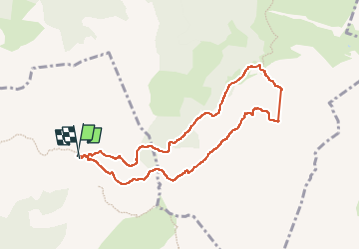
Trail Walking of 8.5 km to be discovered at Auvergne-Rhône-Alpes, Upper Savoy, Le Grand-Bornand. This trail is proposed by Fab-Oz.
Description
Au départ du Col des Annes
montée hors sentier vers Bella Cha
Descente difficile dans le cours d'eau à sec pour rejoindre le GR96 puis retour au Col des Annes
Positioning
Country:
France
Region :
Auvergne-Rhône-Alpes
Department/Province :
Upper Savoy
Municipality :
Le Grand-Bornand
Location:
Unknown
Start:(Dec)
Start:(UTM)
308050 ; 5093748 (32T) N.
Comments